Booming Infrastructural development is turning Geotechnical Engineering one of the most highly paid, Easy- entry and In-Demand Job
Geotechnical Engineering deals with engineering activities of earth and materials. Being a part of civil engineering, it is also used across industries such as petroleum, mining, or any other engineering activity related to construction.
As every building needs a foundation, Geotechnical Engineers are always in a great demand wherever there is a construction project carried out. Geotechnical needs should be integrated with construction and architecture activities during a construction project as these methods proposes the civil engineers to lay firm foundations for the building making them strong against any or every threat.
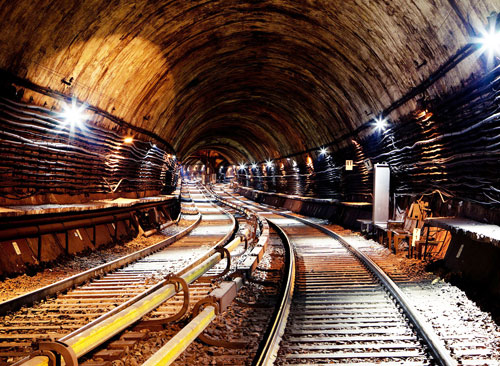
Geotechnical Engineering is the science that explains the mechanics of rock and soil and its applications for construction purposes. It includes the analysis, design and construction of foundations, structures, buildings, slopes retaining structures, embankments, tunnels, roadways, levees, landfills and wharves and other systems that are made of, or supported by soil and rock.
Challenges that Geotechnical Engineers face
Civil engineering is constantly striving to build bigger and bigger structures; Geotechnical engineers constantly develop new techniques to make the underlying ground support for those structures. Longer and higher bridges carrying traffic, skyscrapers and huge buildings, all these are structures that need a firm support to with stand all natural environments, traffic and natural disasters.
New challenges in foundation designs are yet to be faced as mankind is moving forward with long tunnels, higher bridges, speeding highways and more skyscrapers and all this achievement can only be attained having high technically trained professionals.
With all these civil engineering futures, there will and always been a greater need for a Geotechnical engineer. This is a field that will seek innovation with a solid engineering background.
Career Requirements
Students and individuals seeking a career in the field of Geotechnical Engineering can attain high goals possessing requirements such as:
Degree Requirement- A bachelor degree, although some employers prefer a graduate degree in Civil Engineering.
Entry Level Work- A study about the basic structures is carried out at entry level before moving towards more detailed Geotechnical engineering. The candidate, after graduating, work with the CAD software to design and test structural models for construction purposes. The candidate also takes soil and rock samples to analyze and develop Geotechnical reports to receive construction specifications.
Gain Experience- As the new hired candidates gain experience, they are assigned more complex projects. As they gain expertise, they’ll become a lot of concerned in complicated comes. Geotechnical engineers might analyze specifications for bridges, develop support systems for tunnels and assess property problems for dams.
Attain a License- All the firms need engineers to be authorized, whereas necessities vary by firms, licensure typically includes finishing associate degree, licensed engineer program, showing four years of documented work expertise and clearing a state examination.
Faculty graduates could contemplate taking a state – licensing examination on the basics of engineering. Those that pass the examination area unit are remarked as engineers-in-training (EITs).
Job Prospects in India
There is a vast demand for civil engineers in India and it’s conjointly expected to induce a lift because the country is now empowered to upgrade its infrastructure with an increase in economic and political clout within the world. The career opens plenty of opportunities across various government departments.
There square measures open equally smart opportunities within the personal sector for civil engineers. A significant gap for qualified civil engineers is additionally in the defense force wherever they will build important contribution to the protection of the country.
 Geotechnical Engineering with CADD Centre
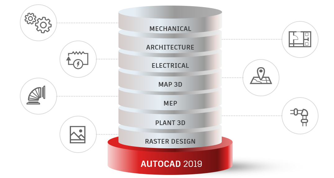
CADD Centre is offering a variety of certifications and courses under its various programs for Geotechnical Engineers to shine their career in the field of civil engineering and Geotechnical engineering. Courses are offered in various combinations as well as standalone versions of world’s most popular CAD/CAE software products such as AutoCAD, Revit Architecture, Revit MEP, 3ds Max, etc.
CADD Centre’s Master diploma programs are offered with an addition course on concept in project management and planning. CADD Centre offers courses such as Master Diploma Program, Professional Program, Diploma Program as well as Standalone Versions.
CADD Centre also offers training and certifications for AutoCAD civil 3D software which is an engineering design and documentation solution which supporting Building Information and Modelling work flows. With all these civil engineering futures, there will and always been a greater need for a Geotechnical engineer. This is a field that will seek innovation with a solid engineering background.
MX Road is another program which candidates learn to build rapid and accurate designs for all types of roads. It is widely used by Civil and Geotechnical engineers and storm drainage/ water/ sewer system designers for accurate and specialized assistance across projects.
The CADD Centre helps candidate’s master features of Civil 3d which is one of the most important software solutions for Geotechnical Engineering purposes:
DESIGN
Design concepts are built for corridor designs, gravity pipe networks, pressure pipe networks, bridge modelling, rail track layout, etc.
ANALYSIS
For advanced mapping functionality, using dynamic model and developing civil design models and visualizations analyzing soil and rock formations.
DOCUMENTATION
These certifications not only master candidates in designing the structures for constructions or doing environment analysis, but also, they will master the art of proper formal documentation.
These certifications and courses will help candidates create professional structures, helping turn their ideas into an actual design. They help to produce detailed plans to aid obtain municipality approvals for subdivisions and land developments.
As a developing country, India has witnessed a rapid growth in the economy, and with this, the construction industry has brought cheers to youth seeking to build career in Civil and Geotechnical engineering making its infrastructure more vibrant.
Image Courtesy: www.subwaybaby.dj
 Plant 3D toolset