Top 5 Features of the Civil 3D 2019

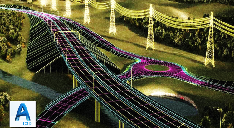
Civil 3D is an engineering software application which is used by civil engineers and other professionals for infrastructure projects. Civil 3D is used to create three dimensional (3D) models of land, water and transportation features. The new Civil 3D 2019 is revolutionary software which can transform the entire construction industry. The top five specifications about Civil 3D 2019 are described below:

  1. Compare Two Versions of the Drawing with DWG Compare

Civil 3D 2019 comes equipped with the fantastic DWG compare feature. With this feature, you can easily compare and review changes in your 3D model and drawing. The compare feature of the Civil 3D 2019 will compare two drawing and create a third drawing with the two overlaid which will help quickly evaluate the differences between the two.

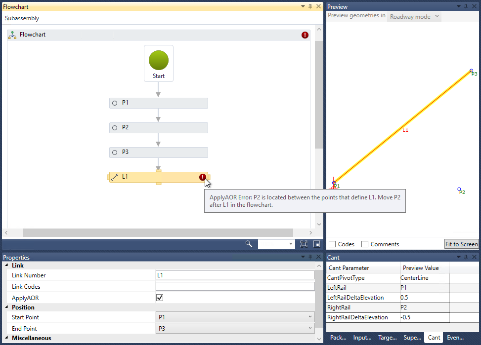
  1. The new ApplyAOR Option in the Subassembly Composer

The ApplyAOR option is an excellent feature of the Civil 3D 2019 which makes subassemblies points dependent on the links on which ApplyAOR function is applied. With this feature, the validation process occurs in Subassembly Compose to check for dependency.

  1. Performance Hotfix and Batch save functions are built in Civil 3D 2019:

Civil 3D 2019 is a powerful and useful product which has the “Performance Hotfix” and “Batch save Utility” also known as the “Autodesk Civil 3D Batch Save” features. This feature makes opening and saving of drawing simpler and faster.

  1. Addition of Vertical Geometry Enhancements for High-Low points:

In Civil 3D 2019, two new direct tools have been introduced for creating Parabolic or Circular curves based on high-low points in Civil 3D 2019. It will help to design the curves for a path, ditch, and road giving you much more control over the location of the high or low point.

  1. Infraworks Component Roads can now be Imported as corridors:

With Civil 3D 2019 you can import Component Roads from Infraworks. This feature not only helps you alignments and profiles but also assemblies and an actual corridor. With this, you can make a great model with a detailed design. The Infraworks model can be opened in Civil 3D 2019 in either IMX or SQLite format. SQLite model has an option to select an area of interest which will automatically open online maps where you can refine the object types.

Apart from all the benefits stated above, Civil 3D also offers many other beneficial tools and features that can amplify many projects such as Pressure Networks, Earthwork Calculations, Grading, Production Drafting, Geospatial Analysis and much more.

Autodesk Releases Revit 2019

Autodesk released the latest version of its modeling software, “Revit 2019” on April 11, 2018. The updates in Revit 2019 are a result of the suggestions and feedback provided by the users on the Revit Ideas page. It added some great and lucrative features across three main categories of Design, Optimize, and Connect.

Addition of the “Or” Variable In Filters

The most famous demand or request on the Revit Ideas Page was for “view graphics” with the “or” option added to view filters. This feature gives users flexibility and power over setting up custom views and a better modeling environment with more immersive 3D features.

Double fill patterns

Autodesk Revit 2019 includes many new design features, including new double fill pattern (foreground and background) files and a library of more realistic renderings of textures for materials like carpets, ceilings, concrete, glass, leather, etc.


Support for Multiple Monitors

Today, the user works with multiple views open at once and are looking for better ways to manage them.  Therefore, Revit 2019 has new Tabbed Views which deliver a modern experience that lets user maximize their working space. Also, it now allows the user to drag views out of the Revit application window to secondary monitors as a means to adjust user’s working space as per their requirement.


Levels in 3D

Revit 2019 supports new levels in 3D views feature, which enables users to visualize building levels in orthographic and perspective 3D views. The user can arrange and organize views exactly as per their requirements. It also adds uncropped perspective to the new version which allows brings them immersive 3D experience without boundaries.


Split Railings

Revit 2019 incorporates the split tool to split railings with a single click. Users can now have separate path sketches for disparate elements. This new release makes it easier for the users to build complicated railings and pipe networks.

Extended Global Capabilities 

Revit 2019 has an entirely new content library for Architects and Engineers. The main component is new content that facilitates multidisciplinary workflow capabilities. This new feature makes Revit work better for users in DACH countries like Germany, Austria, and Switzerland.

In an interview with Architosh, Chris Yanchar, Director, Building Design Products at Autodesk, stated that the continuous user feedback and requests helped Revit 2019 to enhance its designing features and optimize user workflow.

What’s New in AUTOCAD CIVIL 3D 2018

AutoCAD Civil 3D is a documentation and design solution that supports BIM workflows. It also helps engineers, drafters, and technicians to understand project performance better. Users can also streamline time-consuming tasks such as pressure pipes, parcel layout, gravity, and corridor design with some tools and customization design standards. Following are the latest features and benefits:

Pipe sizing and analysis

The changes are introduced in the area of resizing of pipes and resetting inverts. In addition, new feature includes computing of energy and hydraulic grade lines in accordance to HEC-22 2009 standards.

Dynamic offset profiles

Software now enables creation of dynamic offset profiles by using cross slope. It is also possible to create dynamic offset profiles by using the same command such as for offset alignments. Profile geometry offset using a default cross slope, can be modified by editing properties of profiles.

Plan and profile sheet generation

It is now possible to create plan and profile sheet by including more than one plan/profile views on one sheet. Take help of AutoCAD Civil 3D production tools for producing construction documents through drawings. Therefore, you can easily create profile/plan, plan(s), and sections sheets.

Relative Elevation Feature Lines

One can easily obtain feature lines elevations from surface and so, when the surface is updated, the features line is updated. Thus, the update behavior of a feature line varies depending on whether the feature line was set to be relative or just set to be created for absolute elevations.

Connected alignments

There is a new linked alignment and profile connecting two intersecting alignments and profiles. The connected alignment feature can be used to create new alignment and profiles that transition between their profiles. The feature is efficient to create an exit ramp, a merging or diverging road, a curb return, or perhaps for connect existing road to proposed road.

Corridor Overlap Resolutions

In consideration to corridor cleanup issues that are not cleaned up automatically, the new feature is introduced to resolve corridor bowties. Elaborately, at some of the locations on corridor models, the links can now cross each other that result into bowtie-like configurations.

Traverse Editor

Now, you can use the Traverses collection for management of existing traverses within the network. Creation of Traverses from data in a field book file or by using the Traverses Editor for manually entering survey data. For example, you can create data or hand notes from the site plan.

Label Property Set Data

Use Property Set tab within the standard label setup process for adding custom properties to label styles. So, you can now add custom data to AutoCAD Civil 3D 2018 object labels with the use of property sets.